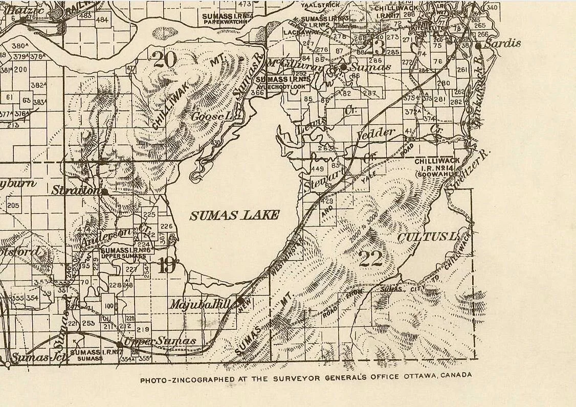
Sumas Lake
Carved into this valley by retreating glacial ice, evolving for over 8000 years & changing with the seasons, Sumas lake sustained a diverse wetland ecosystem, the Séma:th peoples, & neighbouring Indigenous communities. Following the arrival of settlers & their successful lobbying of the new colonial government, the lake was drained in 1924.
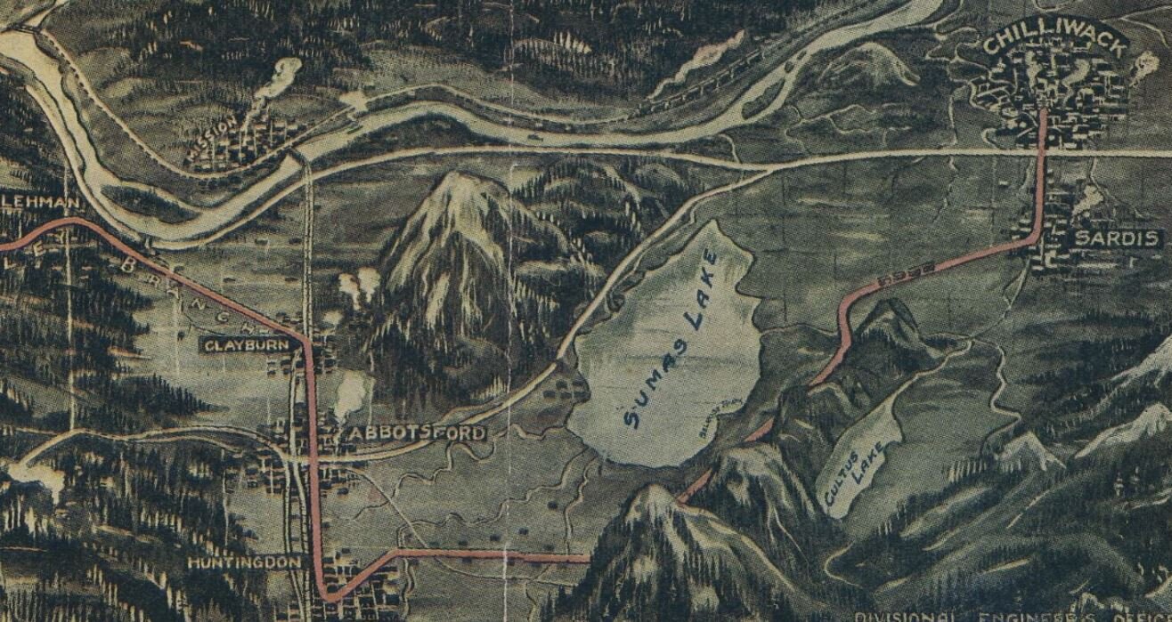
Image courtesy of the University of British Columbia Library Digitization Centre and its generous donors <https://doi.org/10.14288/1.0376526#p6z-7r0f>
(click on images below for full size, hover for credit)


Sumas Lake Loop
The Sumas Lake Loop is a historic self-guided bike ride on gravel trails & quiet country roads. At just over 46km most people could expect to take approximately 2.5 to 3.5 hours, not accounting for breaks.
The route is mostly flat with a gradual climb on Old Yale Road.
Click on map elements or
open in new window for more details & additional photos.


BCER Sumas Substation - Ken Wuschke
Download Files: Cuesheet CSV PDF, Track GPX, Course TCX FIT
Sumas Lake was always changing, growing with the spring freshet from 10,000 acres to up to 33,000 acres. This cycling loop therefore can not follow an exact shoreline, rather it is intended as an interpretative experience & to share the memory & history of this place.
This loop includes sections of public roads, you are responsible for operating your bicycle safely. Use caution at intersection. If you are not comfortable cycling with traffic on the busy No 3 Road Hwy 1 overpass, there is a sidewalk on the west side. You must dismount & walk if using the sidewalk, the railing is not tall enough to safely accommodate cycling.
Be aware that Sumas Prairie may see high winds, you may wish to check the forecast before planning your trip.
At the BCER Sumas Substation, stay to the roadway that passes by the west side of the property & respect the privacy of it’s residents.
SEMÁ:TH XO:TSA: GREAT GRAMMA’S LAKE
Semá:th Xo:tsa, Halq’eméylem for Sumas Lake, existed for millennia on the unceded territory of the Stó:lō peoples. It was integral to the Séma:th & neighbouring Indigenous communities. The draining of the lake had devastating impact on the Stó:lō peoples.
SEMÁ:TH XO:TSA: GREAT GRAMMA’S LAKE, is a children’s book that keeps the memory alive, telling the story of a time when the lake was thriving.
Illustrated by Carrielynn Victor & co-authored by Chris Silver, Carrielynn Victor, Kris Foulds, &
Laura Schneider. Published by The Reach.
SEMÁ:TH XO:TSA: The Untold Tragedy of a Triumph Over Nature

Click here or on the image above to open the presentation “SEMÁ:TH XO:TSA The Untold Tragedy of a Triumph Over Nature” created by Kaeli McIntyre
“In most books, news articles and on public monuments, the story of the draining of SEMÁ:TH XO:TSA is generally told as a congratulatory tale of pioneer triumph over nature. The settler telling erases the experience of the SEMÁ:TH who had lived at the lake since time immemorial, as well as the effect the lake's drainage continues to have on their people.
The following is an attempt at a more thorough retelling.”
Kaeli McIntyre
(click on images below for full size, hover for credit)


More Information & Thanks
The Reach
Chilliwack Museum & Archives
Vancouver Traces
Before We Lost The Lake
Let’s Go Biking
Improving the loop
Our vision for this loop includes wayfinding signage making it easy to follow without a map, interpretive signs sharing the history, & trail connection under Hwy 1 at the Sumas River Bridges. That connection will join this loop with the Mckay Creek & Sumas River Trails (avoiding the No 3 Road crossing), as well as connecting to the Discovery Trail, when the closed portion of Lower Sumas Mountain Road is reopened.